The Problem
Agronomists were already creating Geo Insights. Just not in AgroScout.
AgroScout is a precision agriculture platform built around a live map of field data. Agronomists and field managers use it daily to monitor crops, track issues, and make decisions about intervention.
But when it came to capturing their own observations: spotting a disease outbreak in a specific zone, flagging a configuration issue, noting something worth watching next season. They weren't using the product. They were taking screenshots, drawing on them, and sending them through WhatsApp.
The knowledge existed. It just lived outside the system that was supposed to hold it.
The Insight
The workarounds weren't a habit problem. They were a product gap.
Users had developed their own systems because the product didn't offer what they needed. And those workarounds came with real costs:
WhatsApp threads don't archive by field or season. Insights captured one year weren't accessible the next.
Screenshots with hand-drawn annotations are hard to contextualize and impossible to search.
The observations that agronomists made in the field were never connected to the underlying data layers in AgroScout, which meant they couldn't be analyzed at scale.
Each person developed their own method. There was no shared language or structure for field observations.
The Approach
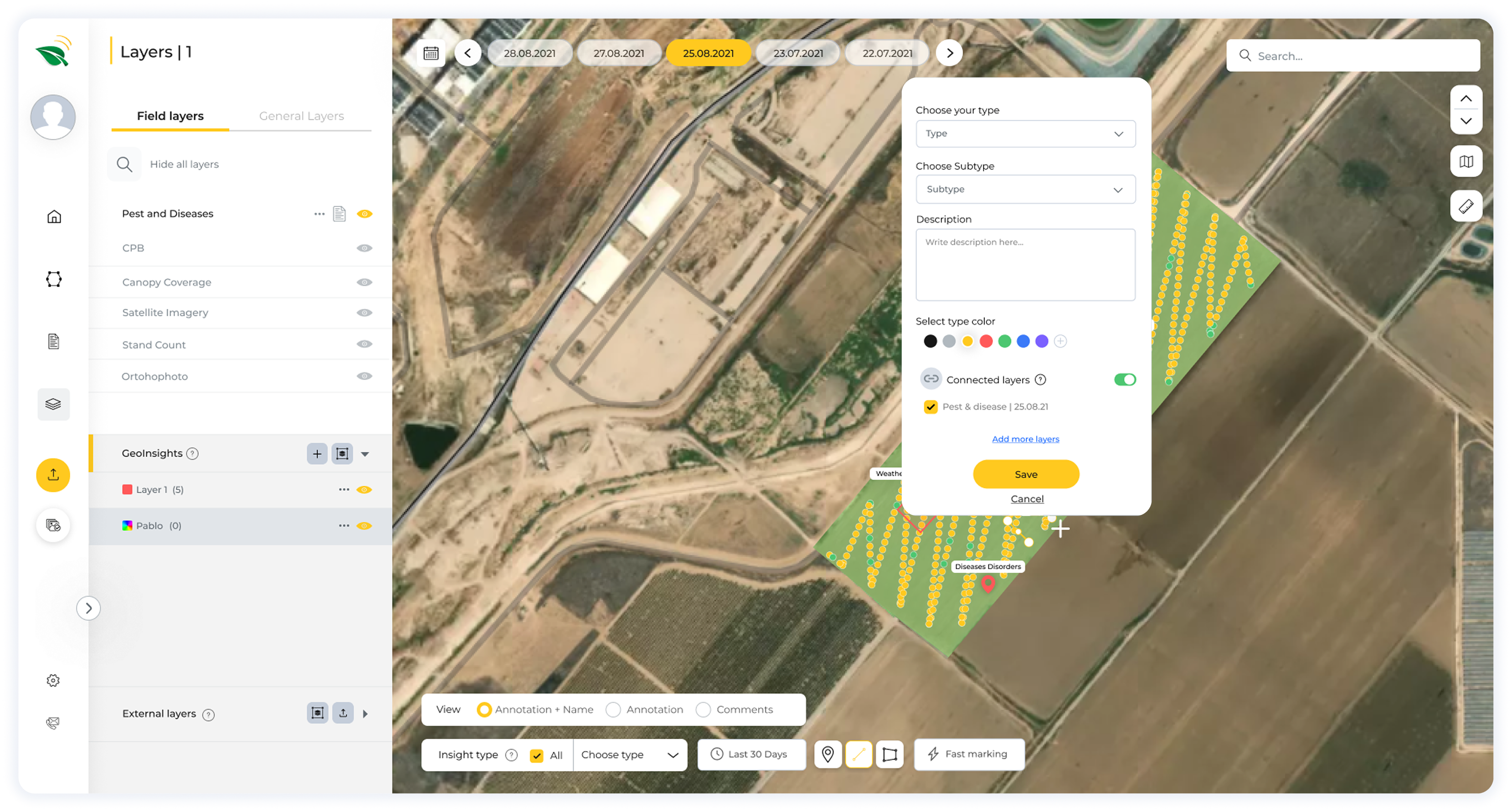
A new layer on the map. Not a new app.
The core design decision: Geo Insights had to live inside the map, not alongside it. Anything that felt like a separate tool would recreate the same fragmentation problem we were trying to solve.
That meant building Geo Insights as a toggleable layer, something users could turn on when they needed it and turn off when they didn't, without disrupting their existing workflow.
A structured object that could carry location (point, line, or polygon), category, metadata, and a link to existing data layers in the product.
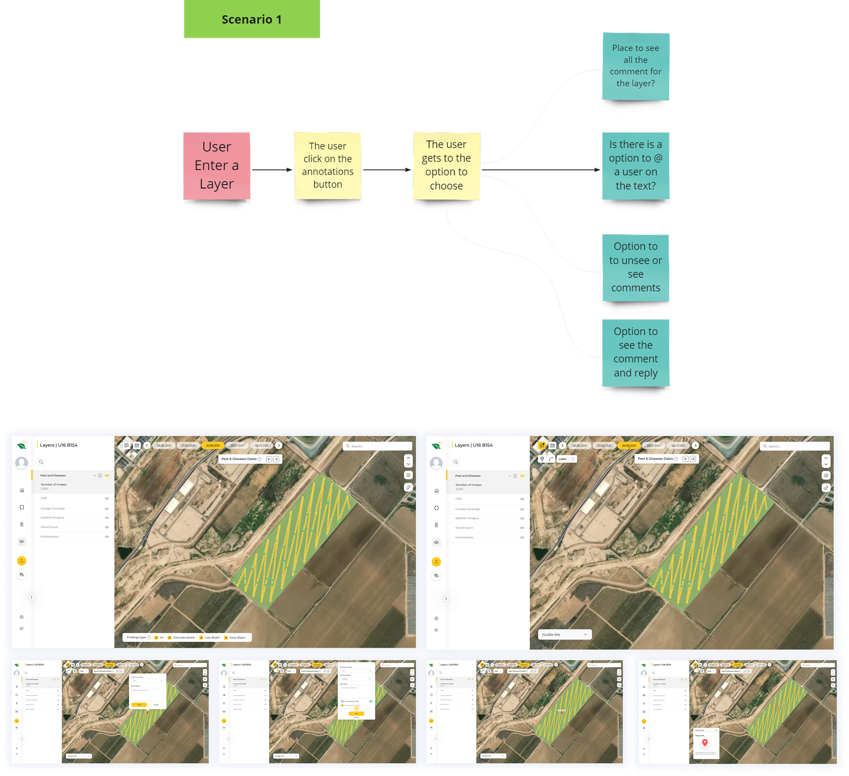
Insights are created directly on the map using geometric drawing tools, the same way you'd mark something on a physical map in the field.
Every insight can be tagged by category and subcategory, with creator, timestamp, and context attached automatically.
The map is already dense with data layers. Every design decision was made with the constraint that Geo Insights couldn't add visual noise. It had to integrate, not compete.
Outcome
Field knowledge, finally inside the product.
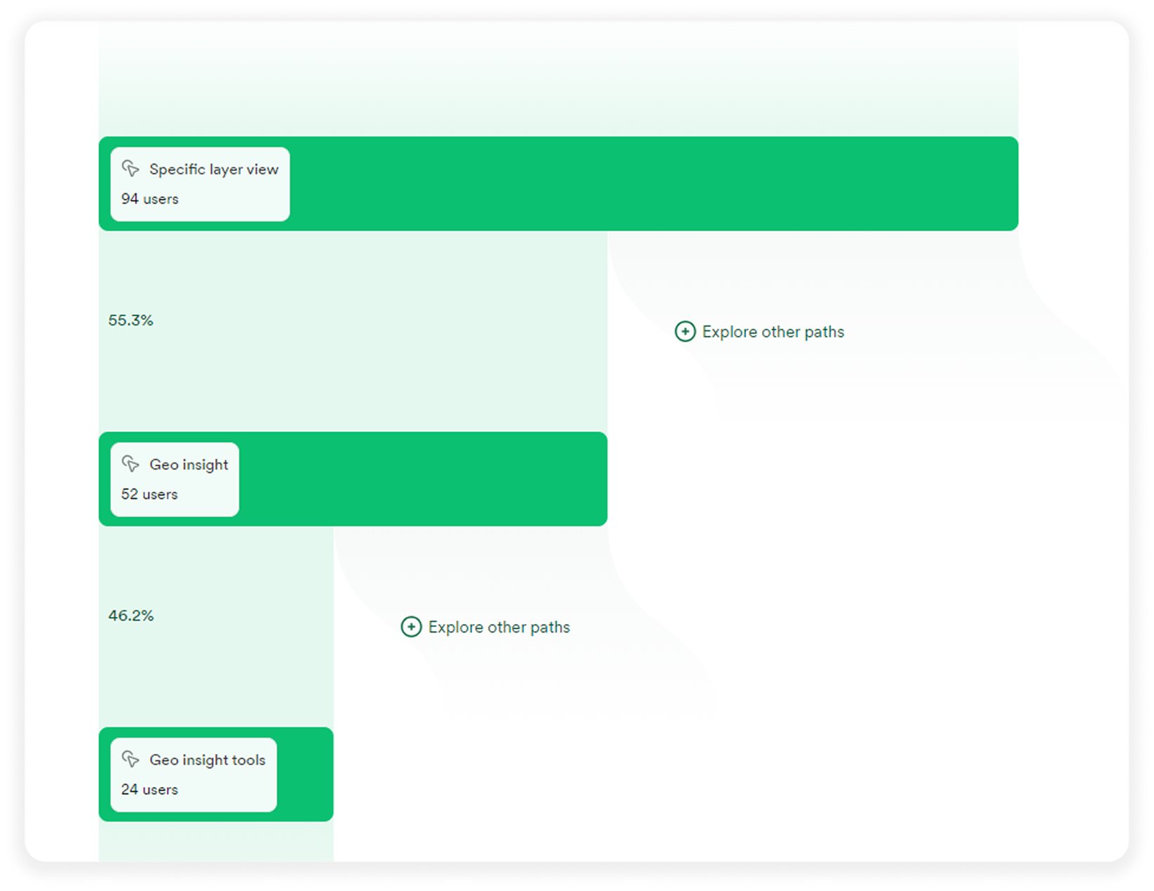
The feature launched and became part of agronomists' daily workflow. What had been informal and fragmented (screenshots, WhatsApp threads, personal notes) could now be structured, shared, and searched inside the same product teams already used every day.
Beyond the immediate use case, the layer created a foundation for capabilities that weren't previously possible: using field observations as training data for ML models, running cross-field analysis over time, and building a searchable institutional memory of what agronomists observe season after season.
Screenshots and WhatsApp threads with structured, searchable field observations inside the product
Field insights to existing data layers, enabling analysis that wasn't possible before
A foundation for ML training, cross-field analysis, and long-term institutional knowledge